Sample report. A real listing, written for an illustrative family (not a real family) to show how every Land Report is written for the family reading it. Listing details are as of the date below; cost figures and practical guidance are marked [EXPERT REVIEW] until a qualified person checks them.
Land Report · for the Sample Family
260 Long Hollow Rd, Clinton, TN 37716
Anderson County, TN · prepared October 21, 2026
At $624,900 the price fits inside your $650,000 budget, and the 7.1 open acres, the shop building and the fast internet match much of what you described.
The land itself scores 84 out of 100. Your score adds your plans, budget and limits (12 points off for plans that don't fully fit).
Your land in 3D
The land's real shape from the elevation map, with the aerial photo laid on it and the buildings already here. Drag to look around; it flies on its own until you touch it.
✓ Good
- About 7.1 acres already open (pasture, hay or fields): plant without clearing
⚠ Watch
- Privacy: 62 home-sized buildings within a quarter mile; you wanted none in sight
- No way out to deep country without driving through built-up areas (Knoxville): rivers and the road network funnel every route back through town
- Part of the land is landslide-prone in the USGS model
- No frontage on a mapped public road: confirm a recorded easement for access
| Score | What we found | |
|---|---|---|
| Location | 91 | Clinton 8 min, groceries 7 min, an ER 16 min, Knoxville 31 min |
| Water | 74 | No creek mapped on the land; wells nearby about 150 ft deep |
| The land | 81 | 1.1 ac gentle, 7.1 ac open, no prime farmland |
| Safety | 80 | 2 things to watch: landslides, tornadoes |
| Energy | 91 | Each kW of solar panels makes about 1,345 kWh a year here; heat about 155 days a year |
| Faith | 100 | Your church: 19 min (Oak Ridge Seventh-day Adventist Church) |
| Value | 100 | Asking $624,900 vs. about $815,000 for 19 similar homes nearby: a good price |
The buildings already here
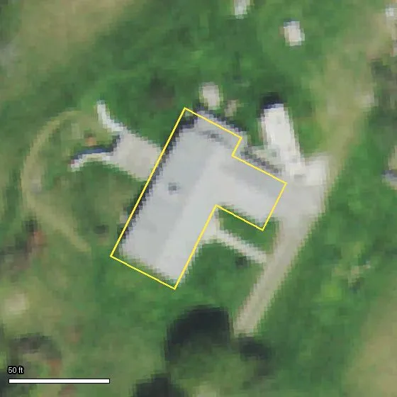
1 building on the land, about 3,504 sq ft on the ground in all. What's already standing is worth a lot of money and years of work: here's what each one is, what shape it looks to be in, and what it could be used for. What to check on each is in Next steps.
A The house
82 × 61 ft · 3,504 sq ft on the ground
From the photo: house; looks sound. A large, multi-part building about 82 by 61 ft, with a driveway that ends at it and a lawn around it. The roof looks fairly even in color, with no obvious missing sections or dark patches.
Roof: Light gray, in several connected sections. One long main wing runs diagonally, with a shorter wing attached at an angle and a small narrow piece off one side. It looks like metal or light shingles, but the photo can't tell which.
What it could be used for: The house: the homestead is planned around it.
Sizes are measured from the building outlines (Microsoft building footprints). Use and condition are read by our AI from a public aerial photo (USDA/USGS, about 2 ft per pixel, often a year or more old): from above you can't see walls, floors or the inside, so confirm everything on your visit.
For the Sample Family
Your drives are within your limits.
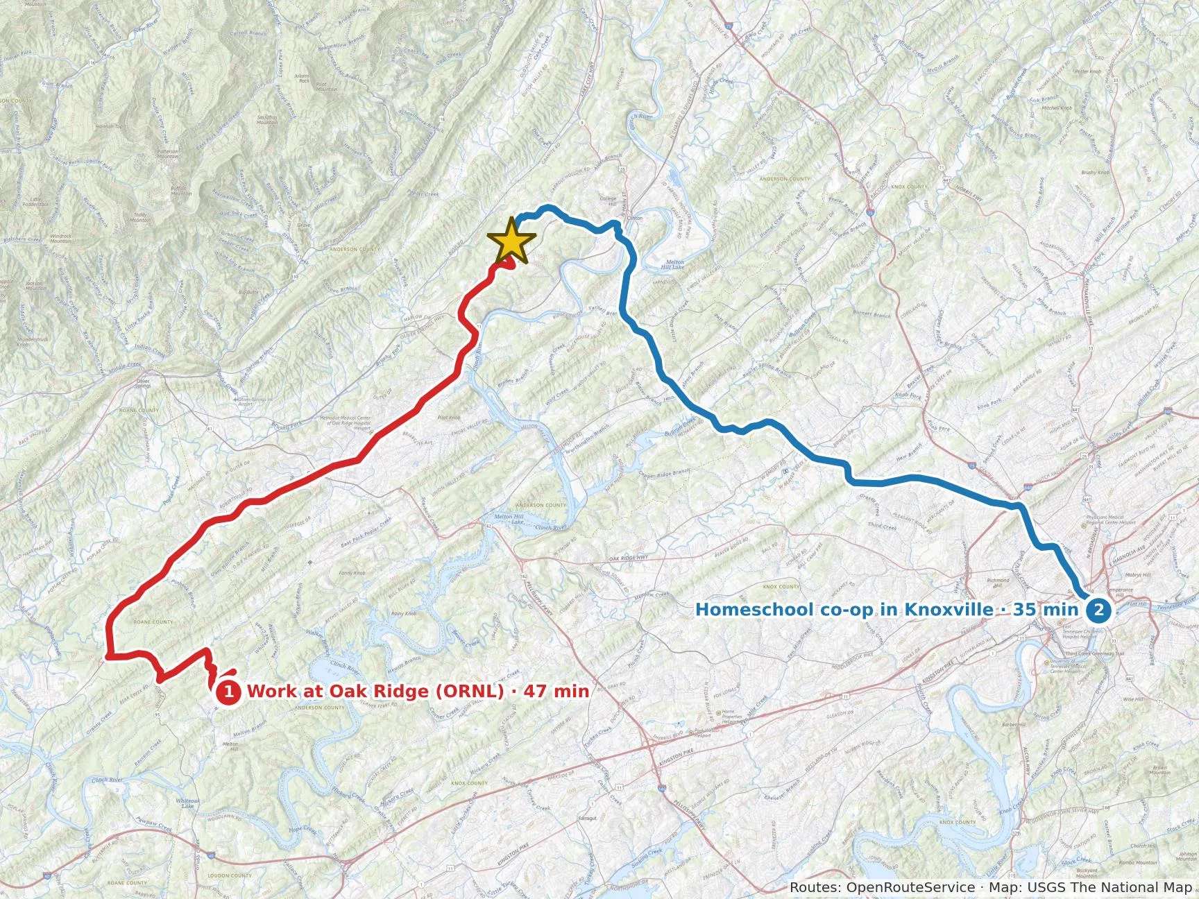
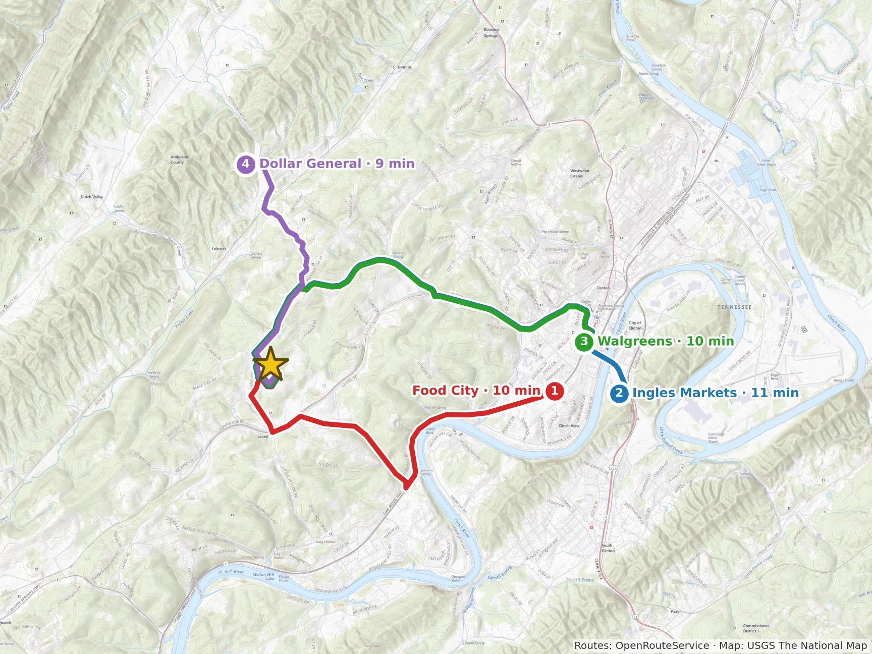
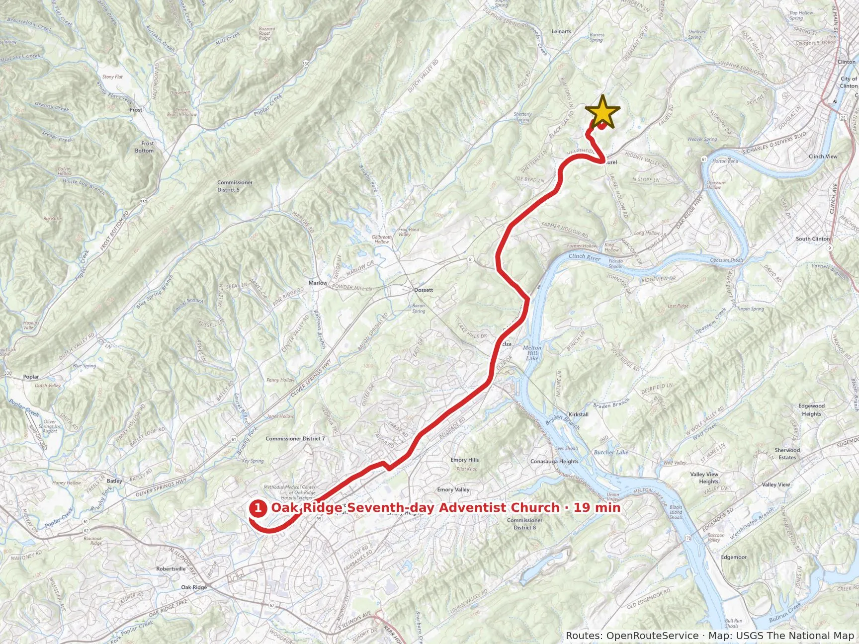
Your drive times
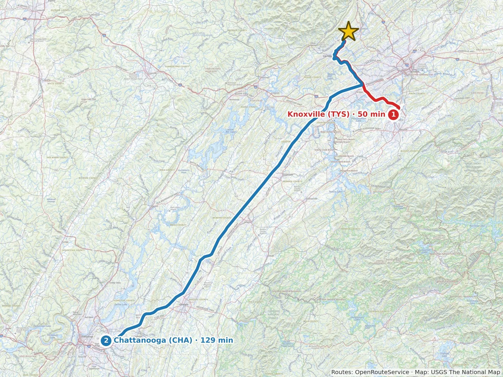

| Place | Drive | How often |
|---|---|---|
| ▸Work and school · 2 · nearest 35 min | ||
| 1Work at Oak Ridge (ORNL) | 47 min | 3× a week |
| 2Homeschool co-op in Knoxville | 35 min | 1× a week |
| ▸Weekly errands · 4 · nearest 9 min | ||
| 1Food City | 10 min | 1× a week (our guess) |
| 2Ingles Markets | 11 min | |
| 3Walgreens | 10 min | |
| 4Dollar General | 9 min | |
| ▸Church · 1 · nearest 19 min | ||
| 1Oak Ridge Seventh-day Adventist Church | 19 min | 1× a week |
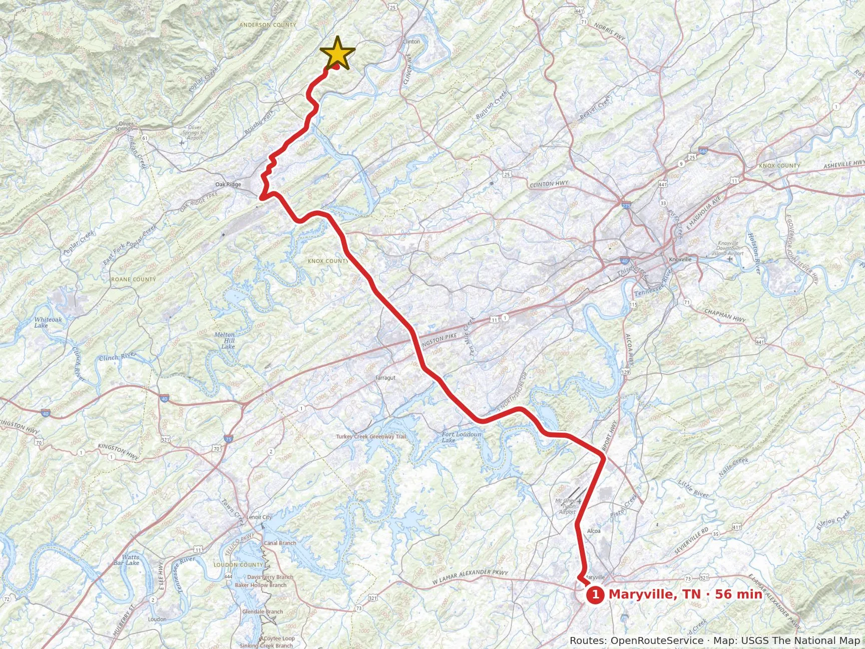
| ▸Family · 1 · nearest 56 min | ||
| 1Maryville, TN | 56 min | |
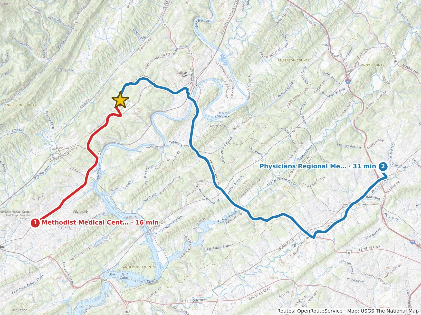
| ▸Emergency · 2 · nearest 16 min | ||
| 1Methodist Medical Cent… | 16 min | |
| 2Physicians Regional Me… | 31 min | |
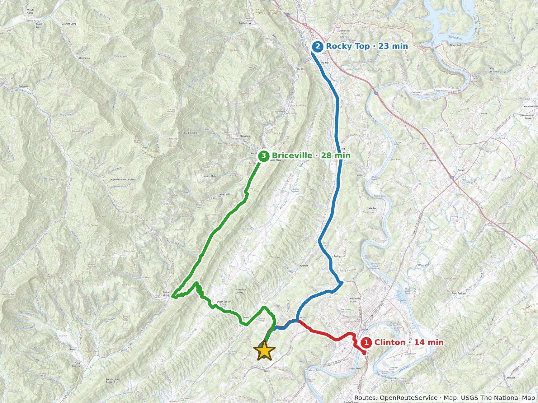
| ▸Nearby towns · 3 · nearest 14 min | ||
| 1Clinton | 14 min | |
| 2Rocky Top | 23 min | |
| 3Briceville | 28 min | |
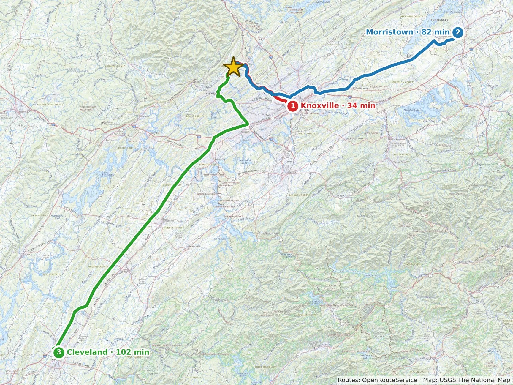
| ▸Nearby cities · 3 · nearest 34 min | ||
| 1Knoxville | 34 min | |
| 2Morristown | 82 min | |
| 3Cleveland | 102 min | |
| ▸Airports · 2 · nearest 50 min | ||
| 1Knoxville (TYS) McGhee Tyson Airport | 50 min | |
| 2Chattanooga (CHA) Chattanooga Metropolitan Airport (Lovell Field) | 129 min | |
Drive times are route estimates without traffic (OpenRouteService). Drive the everyday trips at rush hour before you buy.
Your household
- The listing says 4 bedrooms for your 6 people
- Public schools: Anderson County School District
- Homeschool in TN: Moderate (Light through a church-related umbrella school). Independent homeschool: yearly notice to the district, parent needs a high school diploma or GED, 4 hours a day for 180 days, attendance reported yearly, testing in grades 5, 7 and 9. Through a church-related umbrella school: no notice to the district; the umbrella school handles records and testing. Laws change, so verify with your state and district
Your work
- A shop or workshop: 1 building of 600+ sq ft on the land now (largest about 3,504 sq ft)
Why we say so
- Your plans fit the open ground: 0.8 acres of open, gentle land covers the family garden and hoop house (about 0.31 acres needed), with 6.8 more open acres for 20 fruit trees and pasture for your 3 dairy goats. Your 25 hens have room near the house.
- Your week is workable. Oak Ridge work is 47 minutes each way three days a week, about 4.7 hours weekly. Church on Sabbath is 19 minutes, the Knoxville co-op is 35, and the ER is 16, which matters with four children.
- The shop need is met: there is a building of 600+ square feet (the largest is about 3,504 sq ft). Internet up to 2,000 Mbps far exceeds your 50 Mbps for remote work.
- It falls short of your wishes in places. Only 15% of the land is gentle (you wanted at least 30%), and 62 home-sized buildings sit within a quarter mile when you wanted none in sight. There is no creek, pond or known spring, and only 0.2 wooded acres, so you would need to buy the 3 to 6 cords of firewood a year.
- Watch the household and water. The listing has 4 bedrooms for your 6 people. Your plans need up to about 1,707 gallons a day at summer peak, and the well's yield is not known.
Written by our AI assistant from this report's data and your family profile. It uses only the facts in this report; the verdict comes from our checks.
Will your plans fit here?
4 fit, 6 with caution.
✓ Fits: the land has what this needs. ⚠ Caution: it works, with a tradeoff to weigh. Red flag: a real problem for this plan. [EXPERT REVIEW]
| Your plan | What it needs | This land has | |
|---|---|---|---|
| Family garden (about ¼ acre) + 1 hoop house | about 0.31 acres of open, gentle, sunny ground | 0.8 acres open and gentle | ✓ Fits |
| Orchard: 20 fruit trees | about 0.18 acres, gentle to rolling, out of frost pockets | 6.8 acres of other open ground; 0.0 acres of frost pockets to avoid | ✓ Fits |
| Pasture for 3 sheep or goats | about 0.6 acres of pasture, rotated | 6.6 acres of open ground left after the garden and orchard; 0.2 wooded | ✓ Fits |
| 25 laying hens | a coop and run, about 250 sq ft | room near the house | ✓ Fits |
| Heat with your own firewood | about 3–6 cords a year | 0.2 wooded acres: about 0–0 cords a year, cut sustainably | ⚠ Caution buy firewood |
| Land: gently rolling | at least 30% of the land gentle (under 8% slope) | 1.1 of 7.6 acres gentle (15%) | ⚠ Caution steeper than you prefer |
| Land: a mix of open and woods | 7.1 acres open, 0.2 wooded | ⚠ Caution not quite what you prefer | |
| Water: a creek or stream (would like) | none inside the property lines or nearby | ⚠ Caution not here | |
| Water: a pond (would like) | none inside the property lines or nearby | ⚠ Caution not here | |
| Water: a spring (would like) | springs aren't mapped reliably; ask the seller and look on your visit | ⚠ Caution ask the seller |
Space and firewood figures are planning rules of thumb; open and gentle ground come from the land cover and slope maps. Walk it to confirm.
Location
A settled area, neighbors close by. Drive times are in Your drive times; here are the neighbors, the land around you and the internet.
Internet
| Speeds | For your work: you need about 50 Mbps; the fastest reported here is 2,000 Mbps. Good.
|
|---|
Neighbors
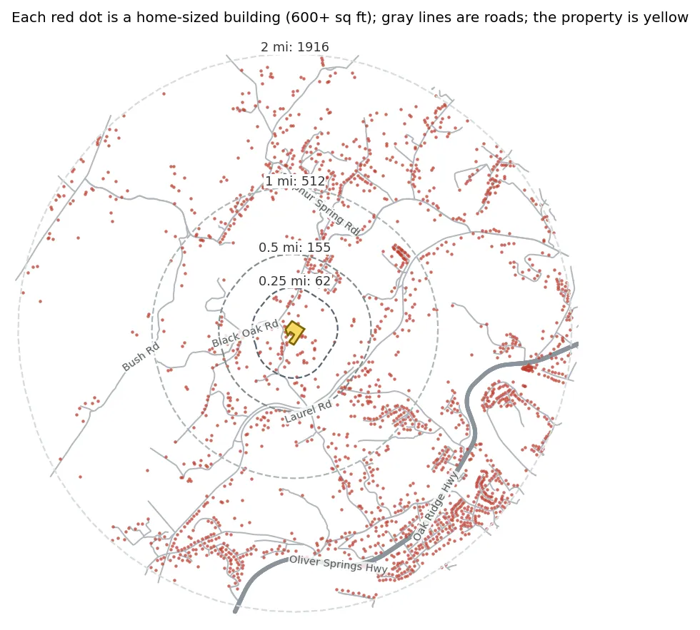
62 homes within a quarter mile, 155 within half a mile, 512 within a mile.
Counted from aerial-photo building outlines; barns and shops of 600+ sq ft count too.
Anderson County: growing slowly (about 1.28% a year) since 2020 (81,449 people).
Road at this address: Long Hollow Rd, local road.
The lots around you
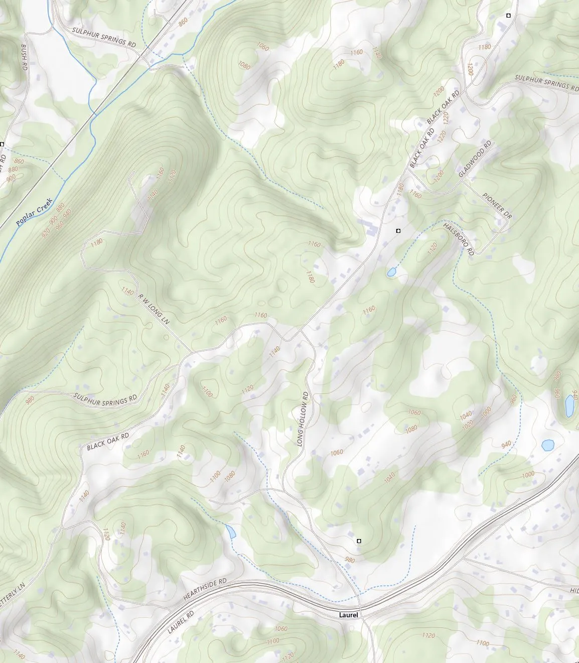 78 ac57 ac54 ac24 ac21 ac20 ac16 ac12 ac11 ac8.3 ac6.5 ac6.0 ac5.9 ac5.4 ac4.2 ac3.2 ac3.0 ac2.9 ac2.2 ac
10 lots touch this property; the middle-sized one is about 2.7 acres, and 5 are under 2 acres. Small lots next door can mean houses close by later. Ask the county what they're zoned for and whether any are being divided. Within a quarter mile there are 52 more lots (lighter on the map), 23 of them under 2 acres. Zoning isn't on the public parcel map here: ask the county planning office. (State public parcel map.)
Businesses and big buildings nearby
Not deal-breakers on their own, but worth knowing before you buy: trucks, noise, lights, smells and traffic come with some of them.
- a very large building (about 14,265 sq ft), about 1,350 ft to the north
From OpenStreetMap, building outlines, and what our AI saw in the aerial photo, within half a mile. Drive by on a weekday morning and ask the neighbors what goes on there.
Water
No creek or pond on the land: the well is your water. The well is the unknown, so test it before you buy.
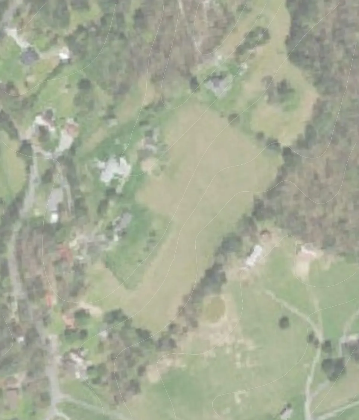

| Creek or pond | None mapped on the land.Your water is the well (below). |
|---|---|
| Well | Not in public records (most private wells aren't). Wells nearby go about 150 ft deep.Ask the seller for the well log and a recent water test. |
| What you'll need | A well that makes at least 13 gallons a minute: twice what your morning chores draw (6.5), so it never runs at its limit. If it makes less, a 2,000-gallon storage tank holds a whole summer day (1,707 gallons) and the well refills it slowly.Never plan on more than half of what a well tested at. Ask for a flow test of 4 hours or more, and size the tank with your driller. [EXPERT REVIEW] |
| Springs | None on the maps. 1 possible spot from the lay of the land (green diamonds).Walk them after a dry spell: wet ground, ferns or rushes are good signs. |
| Rain | about 57 inches a year, with about 5 inches of snow: plenty for gardens and a rain-catchment tank. |
How we worked out your water need
| Household | 480 gal/day |
| Garden and hoop houses (1 inch a week) | 1,186 gal/day |
| Young fruit trees | 29 gal/day |
| Animals | 12 gal/day |
| Summer peak | 1,707 gal/day |
About 780 of those gallons are drawn between 6 and 8 AM: the animals' whole day, half the garden watering and a third of the household's day (our assumptions). [EXPERT REVIEW]
The land
1.1 acres of gentle ground and 7.1 acres already open. No prime farmland mapped, so plan on building the soil. The rest is mostly steep.
How you get in
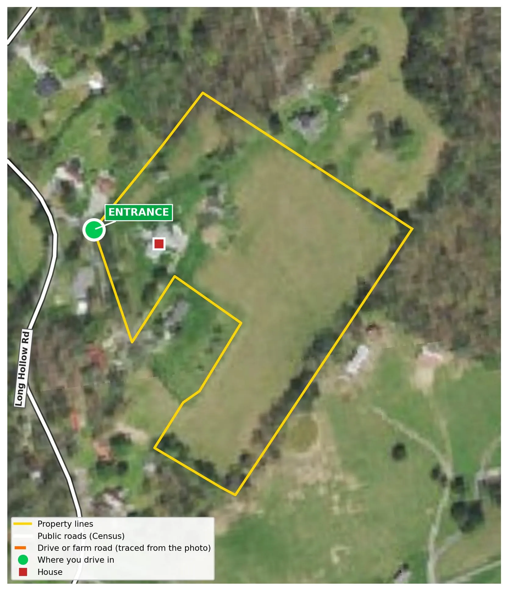
The way in is on the west side of the property, from Long Hollow Rd. The property barely touches the public road: confirm the drive is on your side of the line.
Roads from the Census; the drive traced from the aerial photo by our AI. Confirm the access and any easement with a title company.
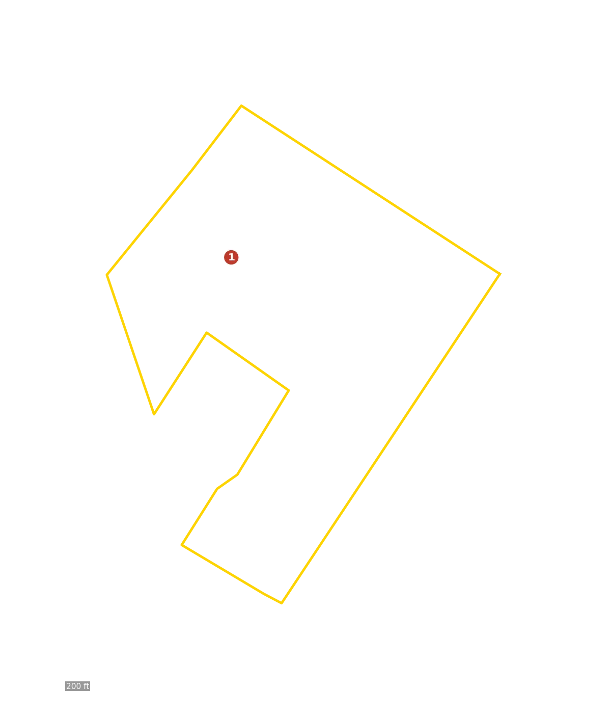
The property lines
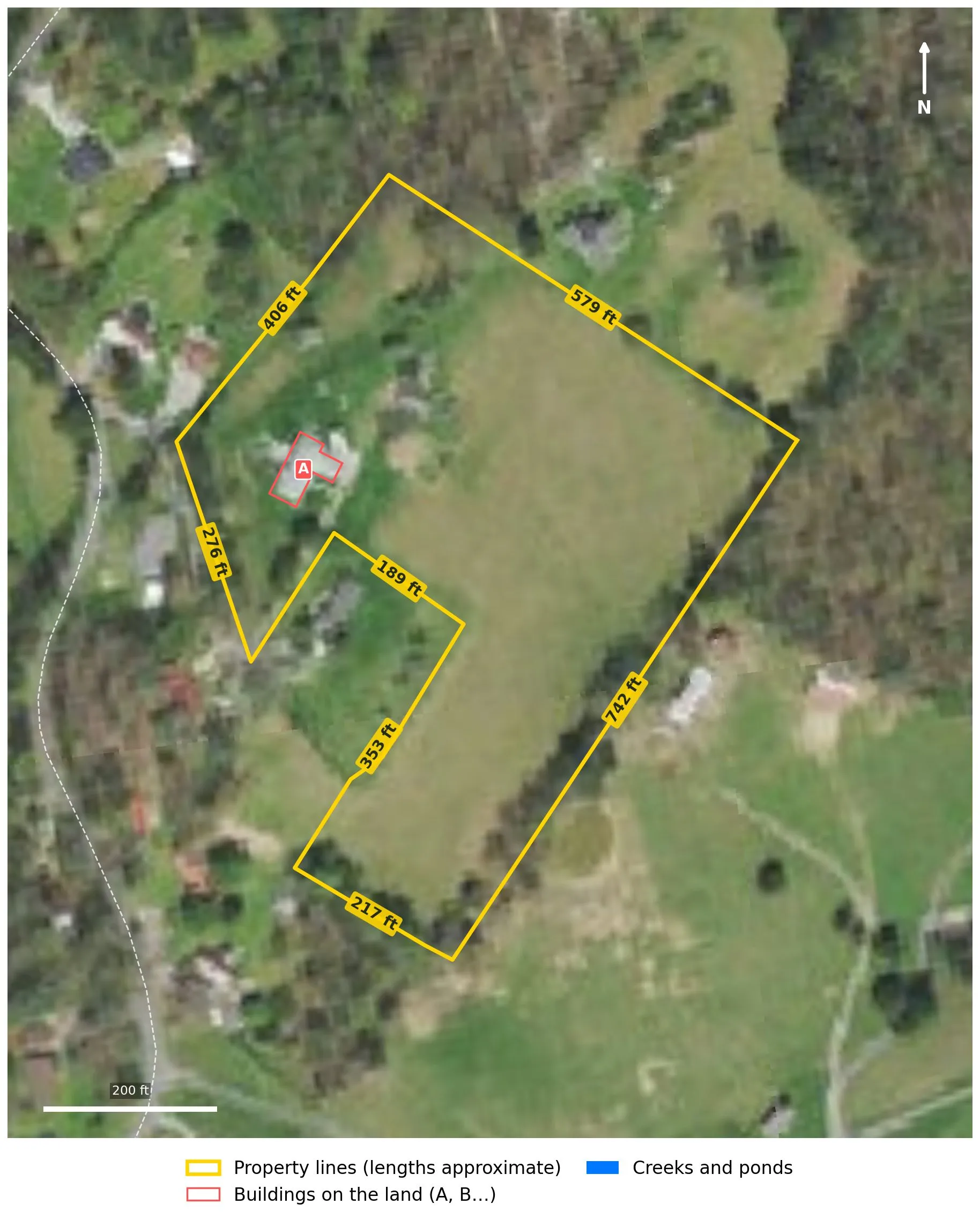
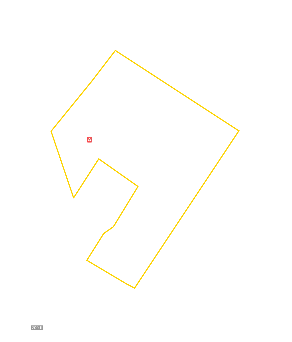
Measured from the public parcel map. Not a survey: only a licensed surveyor can confirm the lines.
The ground
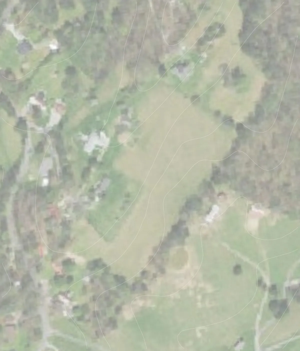






| Faces | northwest 33%, east 31%.Not much faces south: pick the sunniest open spots for the garden. |
|---|---|
| Frost pockets | About 0.0 acres where cold air settles (purple hatching). |
Spots for another building
This property already has buildings, so these matter less: they're the best spots if you want to add a barn, a shop or a second home.
- Site 1: About 6% average slope across the house pad; faces southeast; open ground
Soil




| Soil (USDA) | Acres | Farmland class | Drainage | Septic field rating | |
|---|---|---|---|---|---|
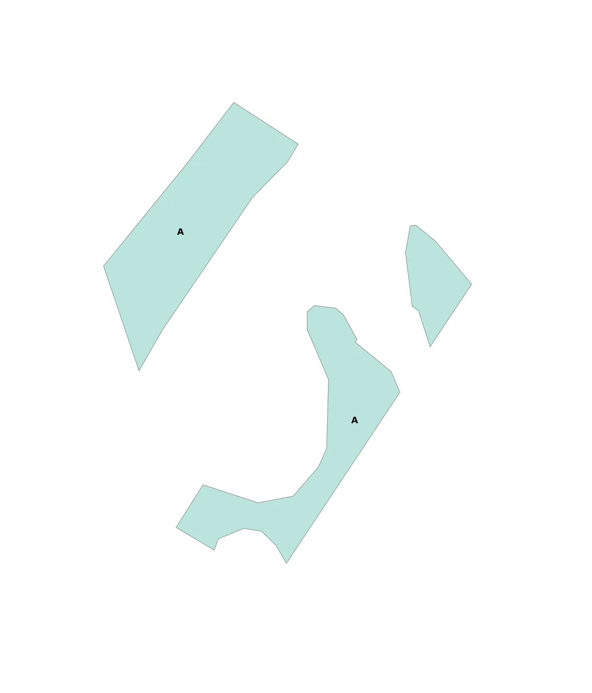
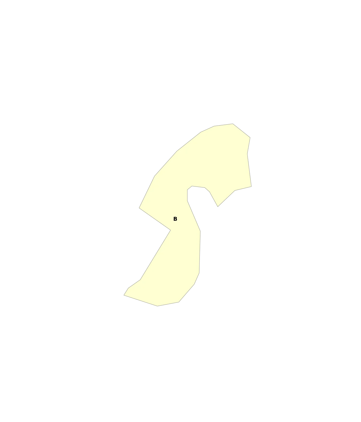
| A | Fullerton-Pailo complex, 12 to 20 percent slopes | 3.3 | Not prime farmland | Well drained | Very limited |
| B | Minvale silt loam, 12 to 20 percent slopes | 2.4 | Not prime farmland | Well drained | Very limited |
| C | Dewey silt loam, 12 to 20 percent slopes | 1.3 | Not prime farmland | Well drained | Very limited |
| D | Ennis gravelly silt loam, 1 to 5 percent slopes, occasionally flooded | 0.5 | All areas are prime farmland | Well drained | Very limited |
| E | Dewey silt loam, 5 to 12 percent slopes | 0.1 | Not prime farmland | Well drained | Somewhat limited |
| Gardens | No prime farmland mapped: raised beds and compost on the gentle open ground.Get a soil test before planting. |
|---|---|
| Septic | The house should already have one; its location isn't in public records. The soils are rated 'very limited' for a new field, so a replacement would likely need an engineered design.Only an on-site soil evaluation decides. Verify with your county. |
Safety
2 things to watch here. Checked and fine: flood zones, ice storms, wildfire, heat waves, hurricanes.
| Landslides | The listing's spot is on ground the USGS national landslide map marks as susceptible. That map rates the whole country from slope steepness and the kind of rock and soil underneath: it shows where slides could happen in very wet weather, not where one has. On this land, about 4.3 acres are steeper than 15% and 1.2 steeper than 25% (the slope map shows where).Keep the house, well and septic off the steepest ground. On your visit, look for slumps, cracks or trees leaning downhill, and have a soils engineer look at any slope you plan to build on. |
|---|---|
| Tornadoes | FEMA rates tornado risk here relatively moderate: about one recorded event every 273 years in this census tract; expected damage of about $180,849 a year across the whole census tract (9 square miles). 24 tornado paths within 25 miles since 1975: 12 EF0, 5 EF1, 4 EF2, 3 EF3. The strongest was an EF3 (136–165 mph winds, severe damage) in 1993, 3.6 miles away, on a path 16 miles long, injuring 3. The closest passed 3.6 miles away (EF3, 1993). Ratings before 2007 are on the older F scale, which is close.Tornadoes reach this area. Plan a storm shelter or safe room (FEMA P-361/P-320 designs), anchor outbuildings, and keep a weather radio. |
If you ever needed to leave
| Flood | No creek or pond near the buildings, so flooding is unlikely to reach the house. |
|---|---|
| Wildfire | FEMA rates wildfire risk here relatively low. No mapped burns within 25 miles.Keep 30+ ft cleared around the house and barns, and know two ways out: the drive comes in from Long Hollow Rd. |
| Hard times | Every route to deep country passes through Knoxville: about 15 of the 23 minutes. In times of unrest or shortage, those are the roads that clog first, so the wiser plan here is to be ready to stay home a while.Keep water, food, heat and a way to run the well on hand for a few weeks, and know your back roads. Prepared, not afraid. |
Worth knowing
Rated in the middle by FEMA: normal for the area, so plan for it, nothing more.
| Winter weather | FEMA rates it relatively moderate, the middle of its five steps: about 5.1 recorded events a year in this census tract; expected damage of about $7,731 a year across the whole census tract (11 square miles).Normal for the area, so plan for it: snow and ice can close rural roads and take out power for days. Keep wood heat or a generator, a stocked pantry, and a way to keep the well pump running. |
|---|---|
| Earthquake | FEMA rates it relatively moderate, the middle of its five steps: about one recorded event every 286 years in this census tract; expected damage of about $147,647 a year across the whole census tract (11 square miles).Normal for the area, so plan for it: strap the water heater, bolt the house to its foundation, and ask a builder about local requirements. |
The full hazard check: storms, quakes, fires, ways out
Storms, earthquakes and fires near here
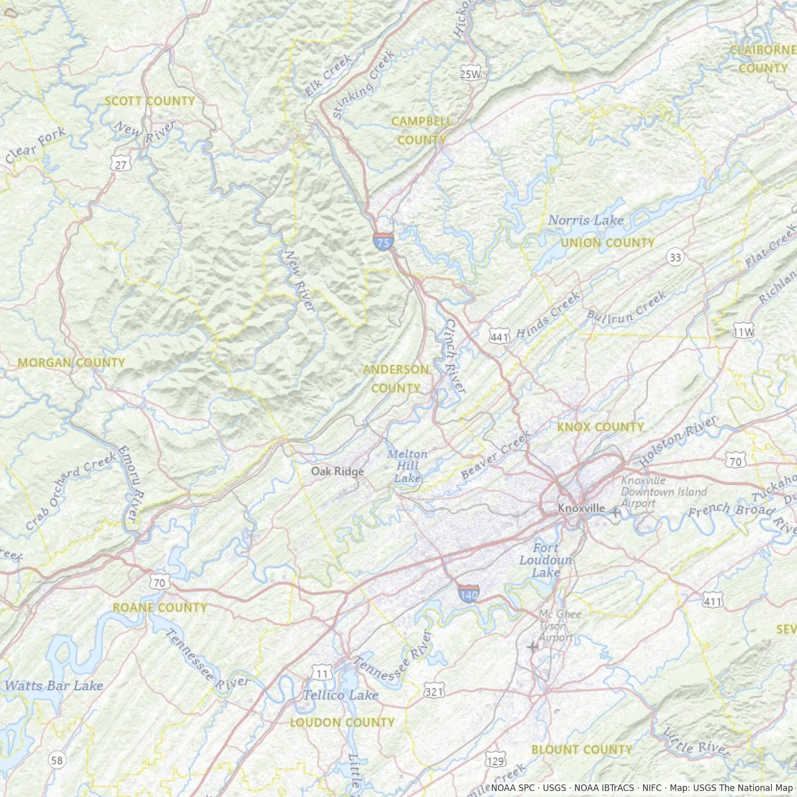



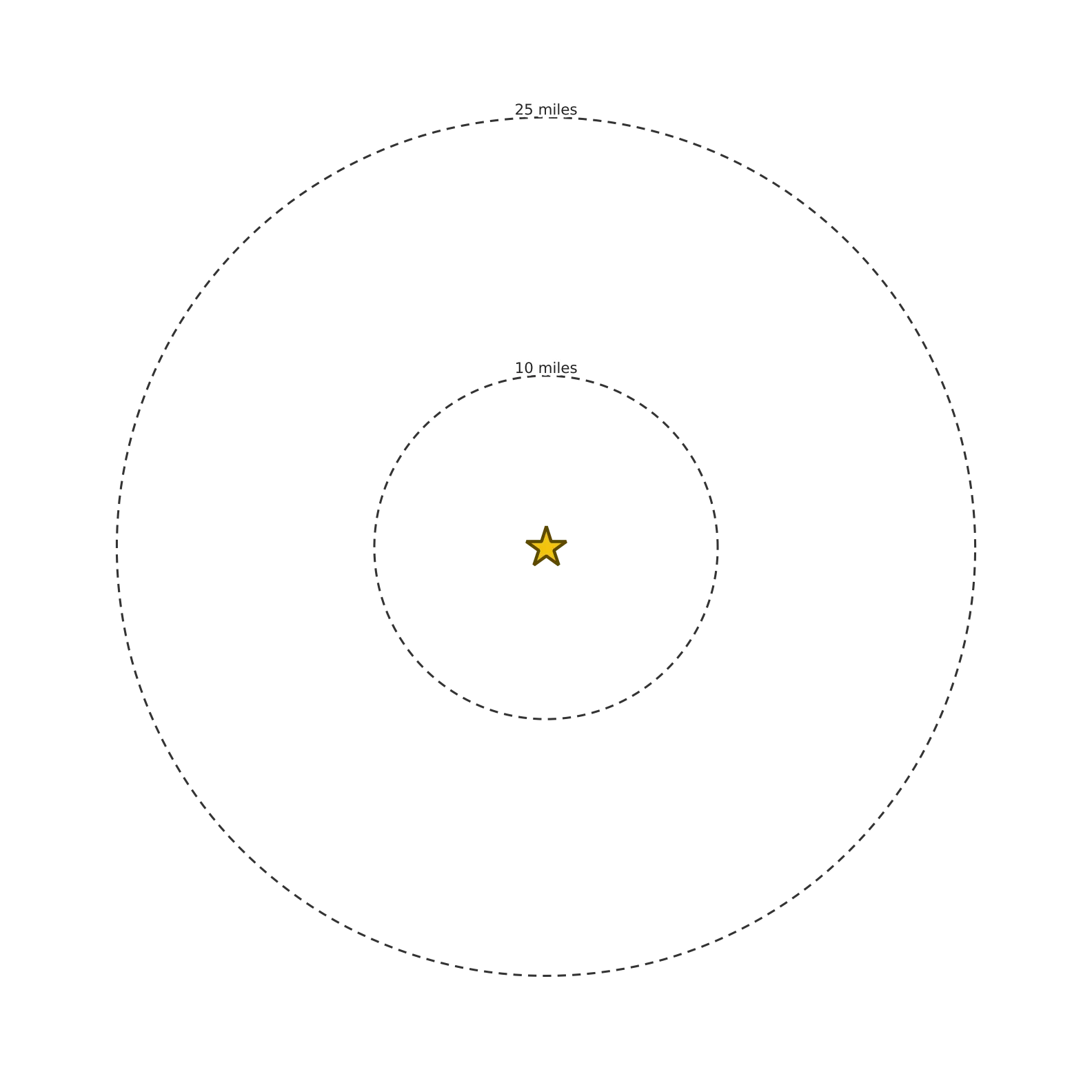
- Tornadoes: 24 tornado paths within 25 miles since 1975: 12 EF0, 5 EF1, 4 EF2, 3 EF3. The strongest was an EF3 (136–165 mph winds, severe damage) in 1993, 3.6 miles away, on a path 16 miles long, injuring 3. The closest passed 3.6 miles away (EF3, 1993). Ratings before 2007 are on the older F scale, which is close. Choose a safe spot (a basement or an inner room on the lowest floor), keep a NOAA weather radio, and think about a storm shelter when you build.
- Earthquakes: 39 of magnitude 2.5 or more within 25 miles since 1900. The largest was magnitude 4.7 in 1973, 23.8 miles away (1 km NE of Alcoa, Tennessee). Quakes this size are felt lightly or rattle dishes; they rarely do damage. Strap the water heater and fasten tall shelves to the wall.
- Hurricanes and tropical storms: 4 storm centers passed within 25 miles since 1950; the closest was Helene (2024), 3.2 miles away as a tropical storm. None was still a hurricane here: this far inland they arrive as heavy rain, so plan for flash floods and downed trees more than wind. Keep drainage clear and a few days of water and food on hand.
- Wildfires: no mapped burn areas within 25 miles (federal fire maps are thin before 2000 and miss many small fires).
- High ground or low ground: this land sits partway up: about 76% of the ground within a mile is lower. It's out of the worst wind on the ridges and the worst cold air and flooding in the hollows. (Our reading of the terrain within a mile.)
From public records: NOAA Storm Prediction Center (tornadoes), USGS (earthquakes), NOAA IBTrACS (storm tracks), National Interagency Fire Center (wildfires). Every place has something; knowing what it is here lets you prepare calmly and build wisely.
Getting out by road
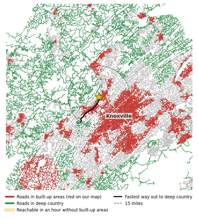
If you ever had to leave in a hurry, could you drive out to deeper country without going through town? We followed the real roads (rivers can only be crossed on a bridge) to deep country at least 15 miles away.
No clean way out. Every route to deep country passes through built-up areas (Knoxville). The fastest one takes about 23 min, about 15 of them in built-up areas (red on the map). In a crisis those are the roads that clog first.
Our reading of the Census road network and our heat map: red = built-up areas (heat score under 45), green = deep country (80+). Drive times are estimates without traffic.
Hemmed in by water?
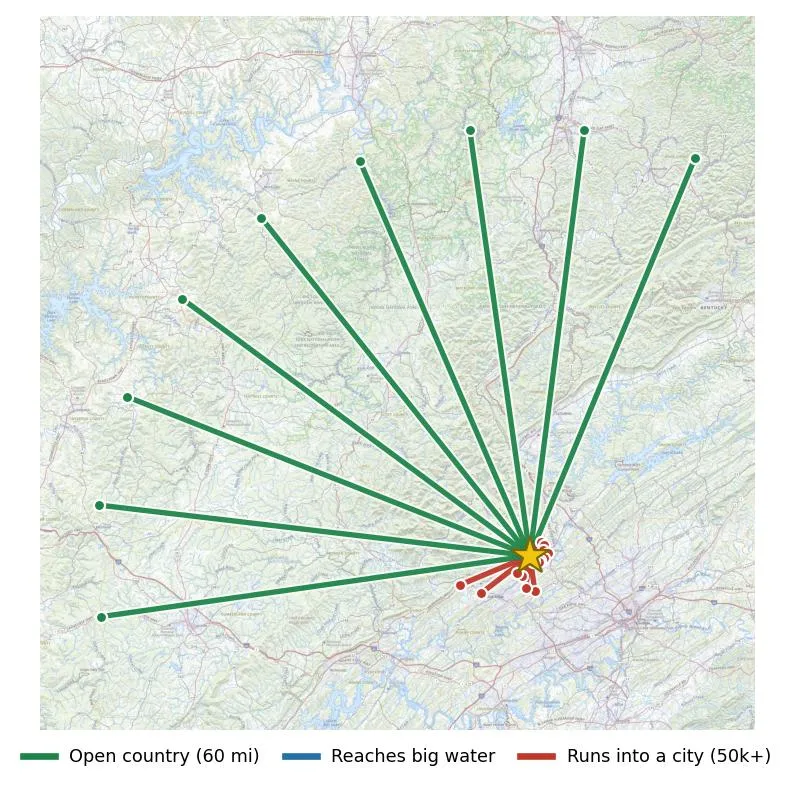
Looking out 60 miles in 24 directions: 9 stay in open country, 0 reach big water, and 15 run into a city of 50,000+ (Knoxville).
Our reading of the Census shoreline and urban-area maps. Small lakes and rivers aren't counted, and bridges aren't counted as ways out.
| Natural hazard (FEMA, this area) | Risk | What it means here |
|---|---|---|
| Tornado | Relatively Moderate | |
| Winter weather | Relatively Moderate | |
| Ice storm | Relatively Low | |
| Wildfire | Relatively Low | |
| Earthquake | Relatively Moderate | |
| Heat wave | Very Low | |
| Hurricane | Very Low |
FEMA's National Risk Index compares each hazard with the rest of the country.
Climate and energy
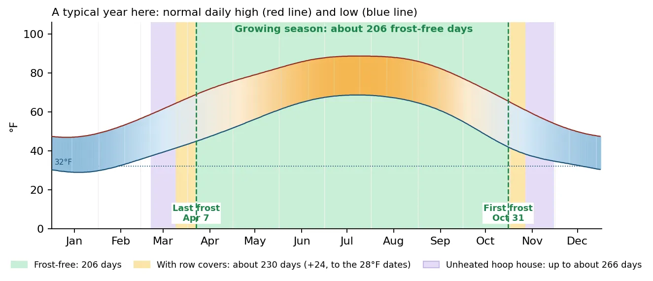
Zone 7b, about 206 frost-free days: last spring frost around Apr 7, first fall frost around Oct 31.
What grows well here: a long season for tomatoes, peppers, sweet potatoes, beans, squash and corn, plus fall greens and brassicas; apples, peaches, pears, blueberries, blackberries and muscadines.
Heating, cooling and season extension
You'd typically run the heat about 155 days a year (Oct 28 to Mar 31) and air conditioning about 125 days (May 21 to Sep 22); about 36 days a year reach 90°F.
Heat on days when the normal daily average is below 55°F, AC when the normal high is 80°F or more. Normals from Oak Ridge Asos, TN, 6 miles away, adjusted to this property's elevation.
Season extension [EXPERT REVIEW]: under row covers (lightweight covers give about 2–4°F of frost protection), tender crops can usually go out around the last 28°F freeze (Mar 25) and stay until the first one (Nov 11), median dates from NOAA. An unheated hoop house can add up to about a month at each end of the season (NC State Extension). Open the sides on warm days, and watch the forecast: a hard frost can still get through.
Solar
| Output | About 1,345 kWh a year from each kW of panels facing south: most in May, least in February. A 6 kW system makes about 8,100 kWh a year.Compare it with the kWh on your electric bills to size yours. |
|---|---|
| Hills | The hills take under 1% of the year's sun. |
| Where | About 0.1 acres inside the lines are open, gentle and face south (gold on the slope map).Keep trees south of the array cut back. |
| Winter | The short season for solar.Plan batteries or a backup for the darkest weeks, and keep wood heat if you can. [EXPERT REVIEW] |
Month by month, and the sun against the hills
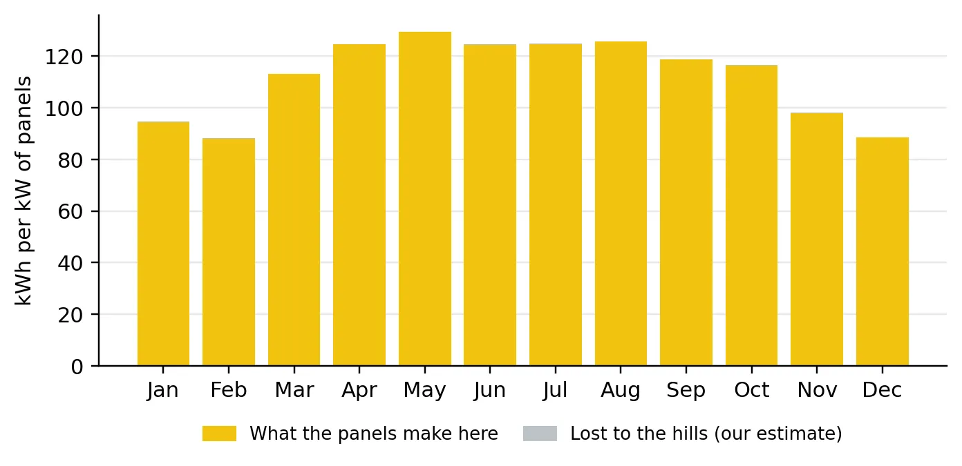
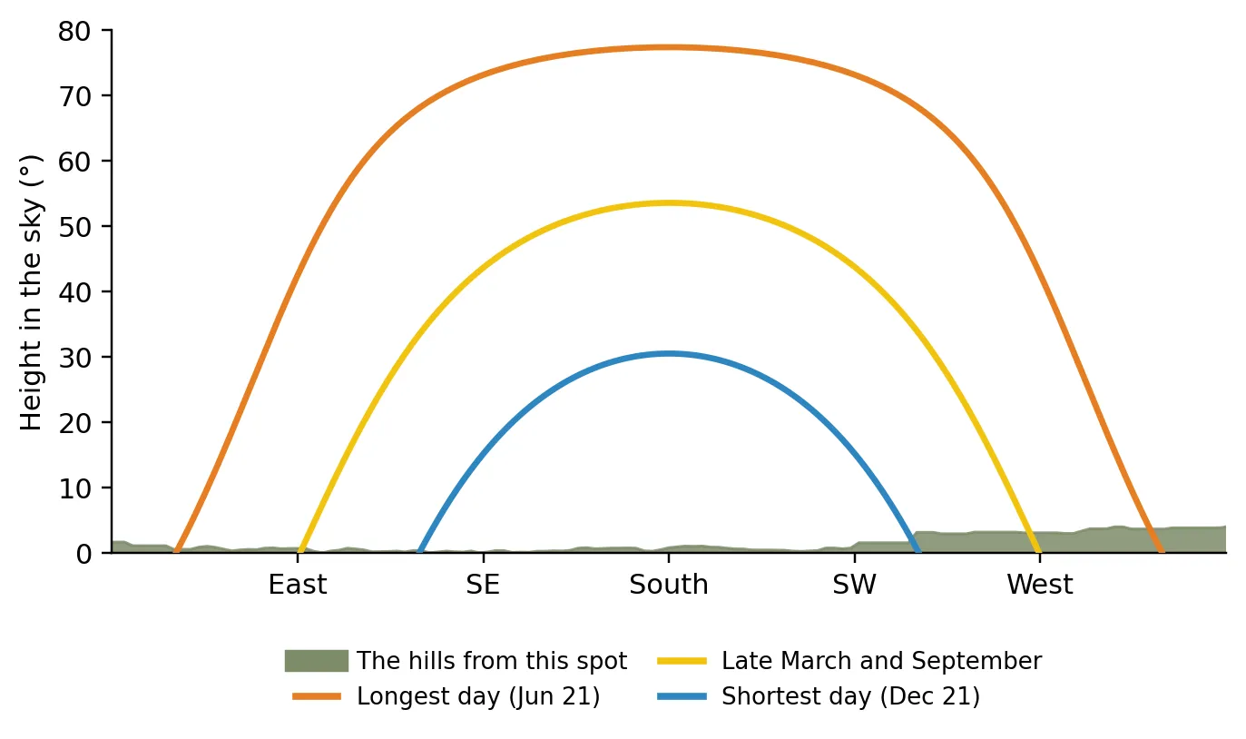
Where the colored line is above the gray, the sun is on this spot.
Solar output: NREL PVWatts (typical-year weather, NSRDB PSM V3 GOES tmy-2020 3.2.0), panels facing south at 31°. The share lost to the hills is our estimate from the elevation map; trees and buildings aren't counted.
Money
All-in about $627,300–$631,400: the asking price plus getting it ready, within your budget of $650,000.
| Getting it ready [EXPERT REVIEW] | Range | Basis |
|---|---|---|
| Boundary survey | $1,500–$3,500 | more for large or wooded tracts |
| Soil evaluation / perc test | $300–$1,500 | county or private soil scientist |
| Home inspection, well-water test and septic inspection | $600–$1,500 | a general inspection plus a water test and a septic pump-and-inspect |
| Getting it ready | $2,400–$6,500 | |
| All-in (asking $624,900 + getting it ready) | $627,300–$631,400 |
Planning ranges from public cost guides and utility tariffs, not quotes. Get three local quotes for each.
Where the money is: land vs. house (our estimate)
| Land: 7.6 acres × about $17,500 an acre (median asking price of 112 raw-land listings of similar size within 30 miles) | ≈ $132,800 |
| House and buildings (the rest of the asking price), about $125 per sq ft for 3,928 sq ft | ≈ $492,100 |
| Asking price | $624,900 |
This is our estimate, not an appraisal: asking prices of similar land nearby, not sales. The county assessor's land and building values are a good second opinion.
Price history
| Listed | Asking | |
|---|---|---|
| 2026-06-27 | $624,900 | 110 days, still listed |
Your monthly payment
Fill in your loan from your lender to see the monthly payment.
Your loan is saved in this browser and used for every property: on the Compare and Budget pages too. Ask the county for the tax rate. An estimate, not a loan offer.
Next steps
Six steps, in the order they happen: free calls first, your own visit, the offer, the paid checks, closing, then building.
1Before you visit
Free phone calls and questions. If any answer is a deal-breaker, stop here.
- Send the listing agent these questions (Melissa Sanders, Stephenson Realty & Auction) free
- Is there a survey, and are the corner pins marked?
- Please send the deed: any easements, rights-of-way, restrictions or covenants?
- The land barely touches a public road: is there a recorded easement for the drive, and who maintains it?
- Any slides, slumps or cracking on the steep slopes?
- Where is the well, and can I see the well log and a recent water test?
- Can I see the septic permit and pumping records? How many bedrooms is it approved for?
- How old are the roof, the heating and cooling, and the water heater?
- What have the electric bills run over the past year?
- Call the county free
- Planning and zoning: What is this lot zoned, and can we keep hens and dairy goats, put up a hoop house, use or build a shop? Any permits or setbacks?
- Septic permits (health department or the state environmental office): What septic permit is on file for this address, and how many bedrooms is it approved for?
- Confirm internet at the exact address with the providers (and Starlink) free
2On your visit
What to look at as you walk it yourself. The professionals come later.
- Find the corner pins and walk the lines.
- Come in the way you would every day: the entrance on the west side from Long Hollow Rd. Would the drive be passable in a wet winter?
- Around the house: the roof line (sagging, missing shingles), the gutters, and whether water runs away from the walls.
- Inside: water stains on ceilings, soft or sloping floors, a musty smell, cracks over doors and windows.
- Read the dates on the water heater and the heating and cooling units.
- Find the well head and pressure tank, and walk the septic area: soggy ground or a smell there is a warning.
- Walk the possible spring spot (green diamonds on the water map): wet ground, ferns or rushes are good signs.
- Look over the steep slopes for slumps, cracks, or trees leaning downhill.
- Dig a few test holes on the open, gentle ground where the garden would go: how deep is the topsoil, how rocky?
- Look for old dumps, tanks or buried debris around the old buildings.
- Drive to Oak Ridge (ORNL) at commute time: we estimate 47 min.
- Talk to a neighbor about their well, the road and what the area is like in winter.
- The house: what to look at
- Roof material, age, and any soft or sagging spots, since the photo is a year or more old
- Foundation, basement or crawlspace, and signs of moisture or settling in a 1972 house
- Age and condition of the electrical, plumbing, heating, and septic or well
- Whether the roughly 3,500 sq ft footprint matches the 3,928 sq ft listing, and whether the attached sections are finished living space or a garage or porch
3Making an offer
Conditions to talk over with your agent.
- An inspection period for the house, the septic system and the well
- A survey before closing
- Clear title and recorded access to a public road
- Mineral and timber rights staying with the land
- Zoning that allows your plans
- Financing and appraisal, if you're borrowing
4Under contract
The checks you pay for during the inspection period, before you close.
- A home inspection: roof, foundation, wiring, plumbing, heating and cooling $600–$1,500
- A septic inspection and pump-out: type, age, size and condition of the system
- A well water test: bacteria and nitrates, at a state-certified lab
- A well flow test of 4 hours or more: at least 13 gallons a minute, twice what your morning chores draw
- A boundary survey: corner pins, true acreage and any encroachments $1,500–$3,500
- A title search: liens, judgments and unpaid taxes
- The title company confirms recorded access to a public road: this land barely touches a mapped road
- The title company confirms the mineral and timber rights come with the land
- A zoning letter from the county: your house plans, animals, outbuildings and selling produce
- Insurance quotes
5Closing
- A final walk-through just before closing: everything as agreed, nothing new wrong
- Owner's title insurance at closing
- Put the deed, the survey, the well log and the septic records in your Vault, so they're never lost
6After you buy
Where things go.
- Lay out fencing for rotating your animals' pasture, with water at each paddock
- Pick the solar spot: open ground facing south
- Put the garden on open, gentle, south-facing ground, and get a soil test before planting
We introduce you to one trusted land agent in this area, free to you.
How we're paid: Plow & Promise may receive a referral fee from the agent's brokerage if you buy through them, at no cost to you. It never changes a score or anything this report says.
Hand us the checklist: we call the county offices, the co-op and the listing agent, and send you the answers in writing.
Sources and disclaimer
- Property lines: TN statewide public parcel map. Buildings: Microsoft building footprints (traced from aerial photos). Roads: Census TIGER.
- Elevation and slope: USGS 3DEP. Aerial photo: USGS National Map. Land cover: USGS/MRLC NLCD 2021.
- Soils: USDA NRCS Soil Survey. Flood: FEMA National Flood Hazard Layer. Hazards: FEMA National Risk Index. Landslides: USGS.
- Water: Census water features; USGS springs and groundwater sites. Climate: NOAA 1991–2020 daily and annual normals; USDA hardiness zones.
- Growth: Census population estimates. Internet: FCC National Broadband Map (2025-12-31). Stores: USDA SNAP retailer list. Hospitals: CMS.
- Drive times: our road-network model. Listing, price history and county price comparisons: RentCast listing data and our analysis of asking prices.
This report is a research guide to help you ask the right questions. It is not a survey, appraisal, inspection, engineering study or legal, tax or financial advice. All lengths and acreages are approximate. Public data can be out of date or wrong for a specific spot. Verify everything that matters with your county, a surveyor, a licensed inspector, a well driller and a real estate attorney before you buy. Scores never change because of any referral or advertising relationship.